


BURLINGTON 2 Voting District, Lawrence County, Ohio
About
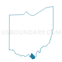
Outline

Summary
| Unique Area Identifier | 648455 |
| Name | BURLINGTON 2 Voting District |
| County | Lawrence County |
| State | Ohio |
| Area (square miles) | 0.70 |
| Land Area (square miles) | 0.68 |
| Water Area (square miles) | 0.02 |
| % of Land Area | 96.94 |
| % of Water Area | 3.06 |
| Latitude of the Internal Point | 38.41149180 |
| Longtitude of the Internal Point | -82.51023240 |
Maps


Graphs
Select a template below for downloading or customizing gragh for BURLINGTON 2 Voting District, Lawrence County, Ohio


Neighbors
Neighoring Voting District (by Name) Neighboring Voting District on the Map
- Voting District 1, Cabell County, WV
- Voting District 12, Wayne County, WV
- Voting District 59, Wayne County, WV
- BURLINGTON 1 Voting District, Lawrence County, OH
- BURLINGTON 3 Voting District, Lawrence County, OH
- SOUTH POINT 1 Voting District, Lawrence County, OH
- SOUTH POINT 3 Voting District, Lawrence County, OH
- UNION 2 Voting District, Lawrence County, OH
Top 10 Neighboring County Subdivision (by Population) Neighboring County Subdivision on the Map
- District 1, Cabell County, WV (17,746)
- Fayette township, Lawrence County, OH (9,194)
- Union township, Lawrence County, OH (9,086)
- Westmoreland district, Wayne County, WV (8,375)
- Ceredo district, Wayne County, WV (7,079)
Top 10 Neighboring Place (by Population) Neighboring Place on the Map
- Huntington city, WV (49,138)
- South Point village, OH (3,958)
- Burlington CDP, OH (2,676)
- Ceredo city, WV (1,450)
Top 10 Neighboring Unified School District (by Population) Neighboring Unified School District on the Map
- Cabell County School District, WV (96,319)
- Wayne County School District, WV (42,481)
- South Point Local School District, OH (12,919)
- Chesapeake Union Exempted Village School District, OH (7,748)
Top 10 Neighboring State Legislative District Lower Chamber (by Population) Neighboring State Legislative District Lower Chamber on the Map
- State House District 89, OH (120,820)
- State House District 87, OH (120,818)
- State House District 16, WV (51,411)
- State House District 17, WV (34,820)
Top 10 Neighboring State Legislative District Upper Chamber (by Population) Neighboring State Legislative District Upper Chamber on the Map
- State Senate District 14, OH (380,921)
- State Senate District 17, OH (360,811)
- State Senate District 5, WV (103,358)
Top 10 Neighboring 111th Congressional District (by Population) Neighboring 111th Congressional District on the Map
Top 10 Neighboring Census Tract (by Population) Neighboring Census Tract on the Map
- Census Tract 511, Lawrence County, OH (6,912)
- Census Tract 512, Lawrence County, OH (5,178)
- Census Tract 203, Wayne County, WV (4,733)
- Census Tract 510.01, Lawrence County, OH (4,603)
- Census Tract 10, Cabell County, WV (2,244)
- Census Tract 51, Wayne County, WV (2,068)